China Travel Itinerary Sketch
Top-saved travel illustrations on Xiaohongshu
China Travel Itinerary Sketch
Top-saved travel illustrations on Xiaohongshu
Showcase
Description
Given a destination, it automates the full workflow: verifying opening hours, transportation, and real landmark details; planning a day-by-day itinerary; and then generating hand-drawn cultural travel illustrations in a consistent style. It ensures landmarks are not fabricated, Chinese text is proofread character by character, time information is independently presented, and the art style remains consistent across days.
Related Skills
View all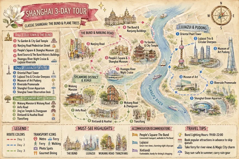 Image
Hand-Drawn Trip Planner
Turn a destination, trip length, and scattered preferences into a multi-day travel plan with logical routes and clear information, then create two shareable landscape hand-drawn travel posters. Whether you provide only “city + number of days” or already have a list of must-see attractions, the plan can organize daily themes, stop order, suggested times, visit duration, meals, breaks, and transportation to minimize backtracking. Any attractions you specify will be fully preserved. When information is incomplete, the plan supplements it with destination attractions, opening information, transportation connections, and practical tips, clearly marking uncertain details for confirmation. You’ll receive two matching visual versions: a daily schedule divided into columns by day, and a map poster centered on a hand-drawn destination map and route. Both images consistently show daily routes, numbered stops, transportation legends, landmark illustrations, and travel suggestions. They use a gentle watercolor hand-drawn style, paper texture, and destination elements, making them suitable for saving, sharing, or publishing as travel content. Text in the images follows your input language: Chinese input produces a Chinese image, and English input produces an English image, avoiding a mix of Chinese and English.
 Write
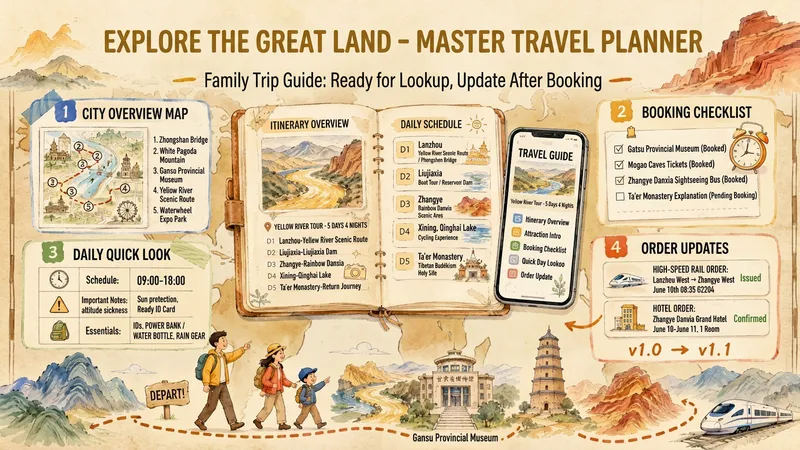
China Family Travel Planner
Tell it where you’re starting, where you’re going, when you’re traveling, and who’s coming along. It will create a domestic China travel guide tailored to your family. What you’ll get • 📄 Travel guide: A booking and ticket-purchase checklist at the top, with checkboxes and deadlines sorted by date, plus a quick-reference table for each day and important reminders for the whole trip. The main section includes a day-by-day itinerary, things to avoid, Plan B options, and costs. • 🗺️ Illustrated city guides: One hand-drawn visual guide for each city, bringing the map, daily routes, food, and lodging together in one place. • 📱 Mobile webpage: Quick access to today’s plans, reservation checklists, and dynamic route maps—ready to use when you’re out and about. What makes it different • Official sources first: Train schedules, opening hours, and reservation rules are based on official sources. Tips from other travelers are labeled separately, and anything that can’t be verified is marked “To be confirmed.” • Tailored to your family: Suitable for families with children, couples, and groups traveling with older adults. The pace is planned around the person with the lowest stamina. • Update after booking: Send screenshots of your bookings. After you confirm, it changes only the affected sections and updates the guide, visuals, and webpage together. > For domestic travel within China only. Does not book or purchase tickets on your behalf.
 Image
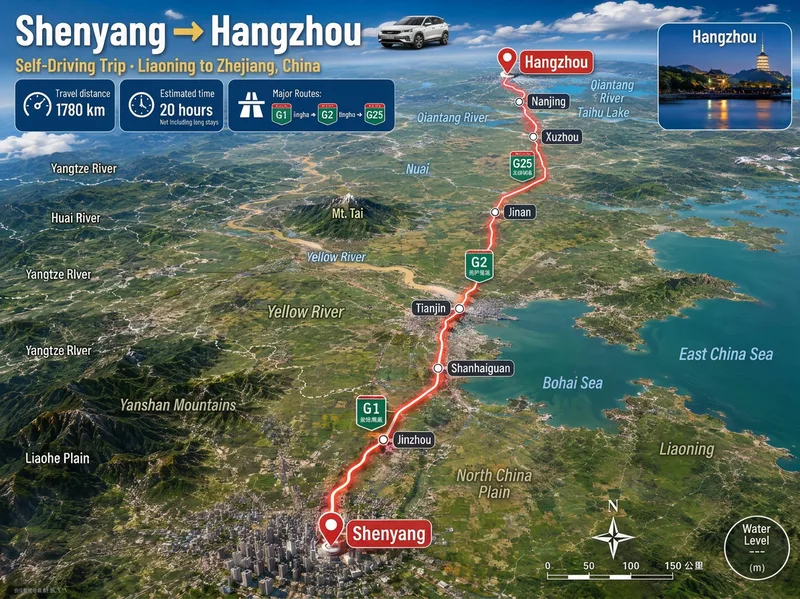
3D Aerial Route Map
Ideal for: 1. Travel, road-trip, and local discovery content creators. 2. Guide creators on Xiaohongshu, Douyin, and WeChat Official Accounts. 3. Operators at travel agencies, guesthouses, car rental companies, and tourism bureaus. 4. Video editors who need "route animation assets" for short-video openings and transitions. 5. Teachers, geography enthusiasts, and people creating educational travel materials. 6. Anyone who wants to make a commemorative "Our Route" poster for a partner or friends. Enter a city, town, village, or country. Mountains, deserts, river valleys, and coastlines are recreated from real maps, with distance, travel time, road numbers, and stops provided at once. The image includes a prominent headline, three information cards for distance, travel time, and the main route, a glowing red route line, labels for real stops, road-number shields, province or country borders, names of mountains, deserts, forests, and other terrain along the route, a small destination landmark image, a compass, and a scale bar. The default format is 3:4 portrait with Simplified Chinese. Both the aspect ratio and language can be customized. Routes across seas or continents automatically switch to flight paths or dashed ferry routes.
Information
- Version
- v5
- Last updated
- Runtime credits
- Usage-based
- Models
- Auto