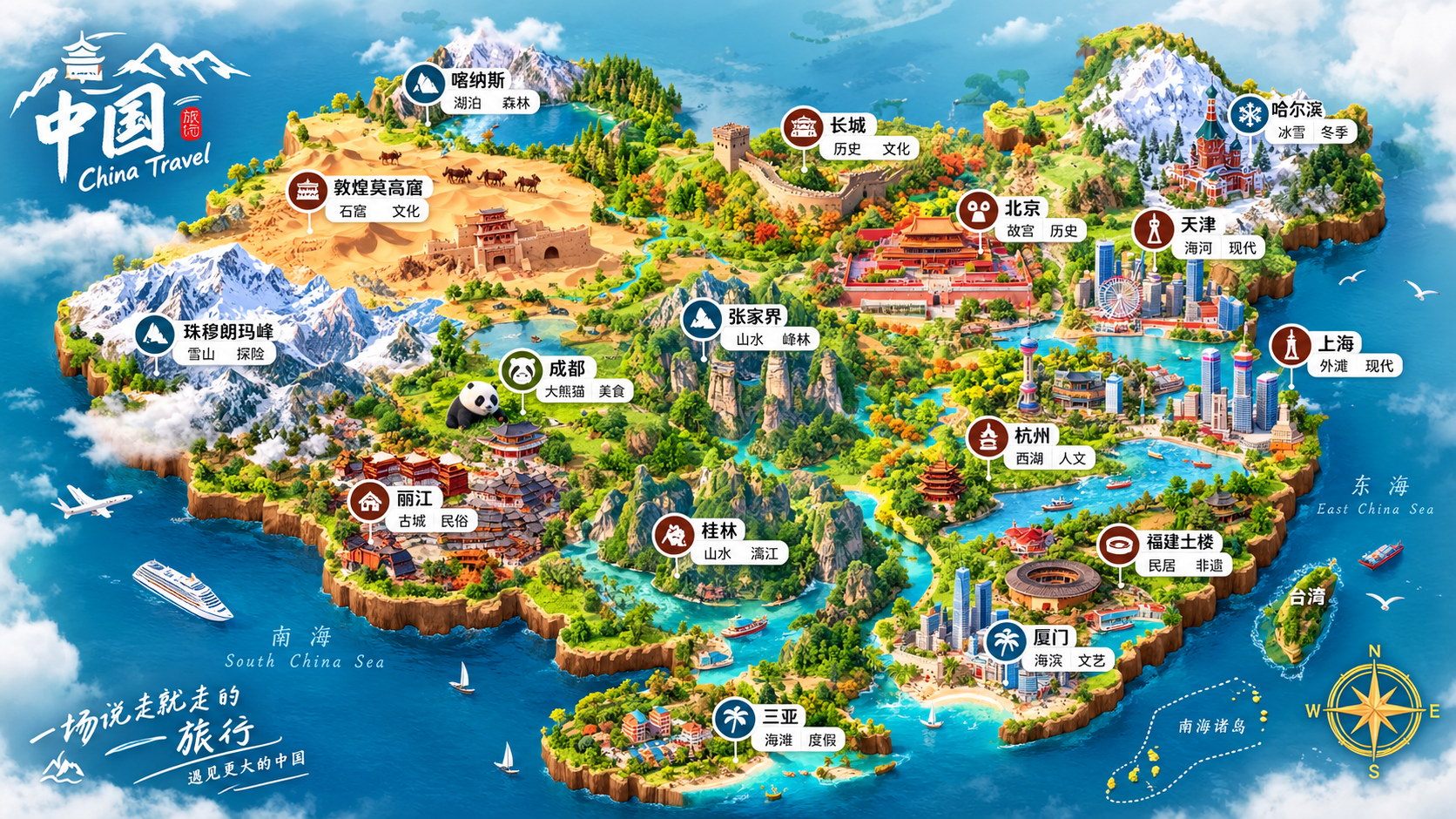
Miniature Maps for Any Place
Turn any place into a 3D travel map
Miniature Maps for Any Place
Turn any place into a 3D travel map
Showcase
Description
Best for: travel bloggers, tourism promotion, geography and culture education, hometown promotion, travel guide covers, and social media series. Turn any place into a miniature diorama you can hold in your hands. Just enter a place name. The Skill first identifies whether it is a country, province, city, or town, then researches the area's most representative real landmarks, cultural symbols, and local specialties. Finally, it generates a bright, finely detailed 3D isometric miniature travel map poster. ✅ Landmark research: verify first, then illustrate—no invented buildings, attractions, or place names ✅ All location levels: country / province / city / district or county / town / scenic area ✅ Clear information: place name + icons + keyword labels make each area's character easy to understand at a glance ✅ Default 3:4 portrait format, suitable for Xiaohongshu, Douyin covers, and Pinterest ✅ Flexible styles: 3D miniature, clay, pixel art, watercolor, paper cut, or low-poly ✅ Series-ready: maintain a consistent style for batches such as "All Provinces of China," "Northeast China’s Three Provinces," or "Cities Across China" ✅ Supports Chinese, English, and bilingual Chinese-English labels
Recommended by
Dancang
Why we love this skill
Combines verified geographic research with handheld 3D miniature dioramas to recreate destinations through landmarks, orientation, and cultural symbols—without fabrication.
Best for
Ideal for travel bloggers, tourism promoters, and geography and culture creators making place-themed map posters.
How to use this Skill
Provide your input
Enter a place name, with optional ratio, visual style, season, key landmarks, label language, and brand text.
Run the Skill
The system identifies the place type, compiles verifiable landmarks and geographic elements, and creates a travel map poster concept and image prompt.
Review your result
Get a bright, clear 3D miniature travel map poster for introducing a place, covering travel tips, or creating a themed series.
Related Skills
View all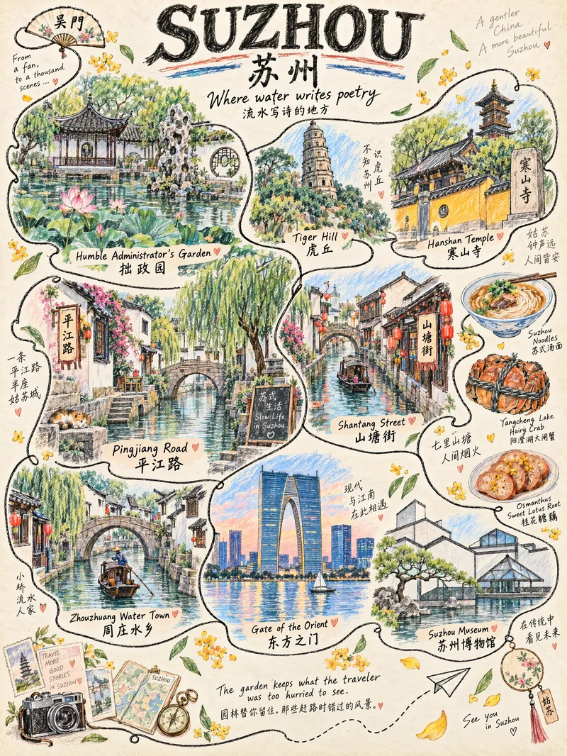 Image
One-Line Travel Poster
Anything can be illustrated: countries, provinces, cities, counties, towns, and villages are all supported. The system automatically identifies the geographic level—choosing landmarks for larger places and capturing the character of everyday life in smaller ones. ✏️ Authentic hand-drawn feel: colored pencils and crayons, with visible paper texture, pencil strokes, and naturally unsteady linework 🔍 Details worth discovering: hidden cats, birds, postcards, tickets, and other small surprises that reveal themselves when you zoom in 🔤 Bilingual title: English + Simplified Chinese by default, with customizable languages 📐 Default 3:4 portrait format: ready for Xiaohongshu and Douyin covers, phone wallpapers, and printed decorative art 🎨 Magazine-style layout: an ivory-beige paper background with a handwritten tagline, suitable for sharing on social media, tourism promotion, and travel check-ins Who it's for: Travel bloggers, tourism promotion, social media covers, hometown promotion, birthday or anniversary gifts, and decorative art design.
 Image
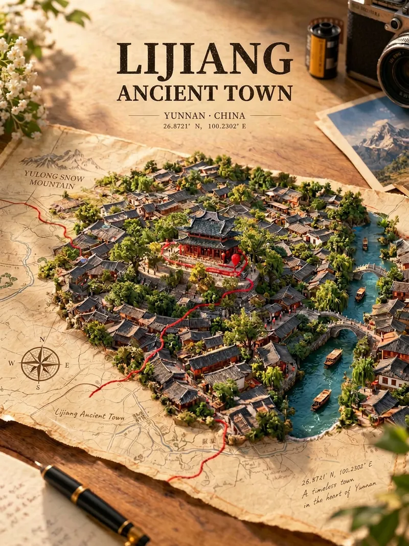
Map Treasure Poster
For travel, geography, history, and urban culture creators; creators making carousel graphics and short-video covers; and account operators who want to produce images in batches at low cost. Enter any place in the world—from a country or city to a town or village—and generate a creative poster showing the city breaking through paper. Real streets, rivers, and iconic buildings slowly rise from a yellowed vintage map, while a red line winds along actual streets before wrapping around the landmark. Landmarks, architectural styles, terrain, waterways, and coordinates are all recreated according to the real location, with no random drawing or mix-ups. The default format is a 3:4 portrait layout, with bilingual Chinese-English poster text. The aspect ratio and language can be customized.
 Image
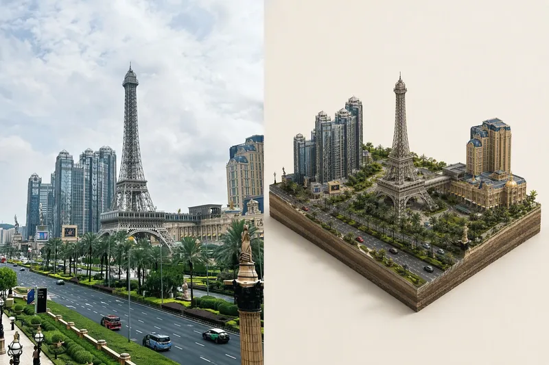
Tiny World Studio
An elite geographic visual designer and AI art prompt engineer. Best for: city landmark check-in images, travel memory posters, scenic area promotions, real estate and urban planning illustrations, WeChat Official Account headers, and Xiaohongshu covers. Use this Skill when you provide a real-world photo or a place name: ✅ Photo first ✅ Automatic aspect-ratio matching: calculates the best canvas and layout based on the photo’s actual proportions, preventing tower tips, rooftops, and people’s heads from being cropped; ✅ Two layouts: comparison image (real scene + miniature) or miniature only; automatically identifies diamond-shaped plots and rectangular skylines ✅ No "beautification" for people: no face retouching, face slimming, body slimming, face swapping, or chibi styling—only a reduction in scale ✅ Parameterized text: provides the location name, time, coordinates, position of the number, font, font size, letter spacing, and color for proofreading and rearrangement after image generation
Information
- Version
- v3
- Last updated
- Runtime credits
- Usage-based
- Models
- Auto
- Use cases
- Images & designLearning & educationMarketing & growth
- What you get
- ImagePrompt
- Visual styles
- 3DWatercolorPixel art